 Gays Mills, Wisconsin
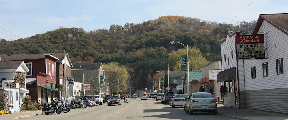
Above: Looking east at downtown Gays Mills, Wisconsin along Wisconsin Highway 171 (2010). Photo By Royalbroil [CC BY-SA 3.0 ], from Wikimedia Commons.
Gays Mills, Wisconsin - "Wisconsin's Apple Country"
The Village of Gays Mills lies in a valley among the steeply chiseled bluffs of the region known as the Driftless Area of Southwest Wisconsin, along the banks of the Kickapoo River.
In 1847 James B. Gay, a native of Indiana, built a dam and a sawmill on the Kickapoo River, which proved to be a flourishing success. When his health started to fail, James convinced his
brothers John and Thomas to move to the area. In 1865 John Gay built the first flour mill south of the saw mill. In the years between 1848 and 1865, many families moved into the community, which came
to be known as Gays Mills in honor of the founder and his brothers.
Gays Mills nearly flooded off the map twice in the past few years.
Normally the Kickapoo River runs its course but in 1978 the river flooded, reaching record levels of almost 20 feet. All was quiet until August, 2007. Extensive rain in the areas upstream from
Gays Mills caused flash flooding and overnight the town filled with water. Homes and businesses filled with water and many people lost everything. The river crested just below the record level
of 1978, and 75 homes were damaged.
Then in June 2008 Gays Mills was dealt another blow. This time, the river broke its previous record and crested at 20.1 feet, seven feet above the flood stage level. During both the 2007 and
2008 floods, the water on Main Street submerged cars.
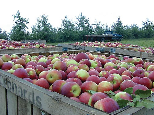
Apple Capital of Wisconsin
The Gays Mills Apple Festival is an annual celebration of the apple harvest with parades, carnivals, arts & crafts, flea markets, music, dancing, food & festivities. It is held the last full weekend in September.
Gays Mills Apple Festival.
Historical Marker of Gays Mills Apple Orchards
For more information on Gays Mills, Wisconsin, visit Wikipedia.
Or, visit the Village of Gays Mills website at www.gaysmills.org.
Gays Mills, Wisconsin
Crawford County
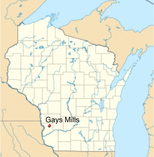
Above: Gays Mills, Wisconsin.
Coordinates: 43°19′6″N 90°50′48″W
Apple Capital of Wisconsin
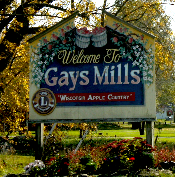
Above: Gays Mills welcome sign. Photo by Royalbroil [CC BY-SA 3.0 ], from Wikimedia Commons.
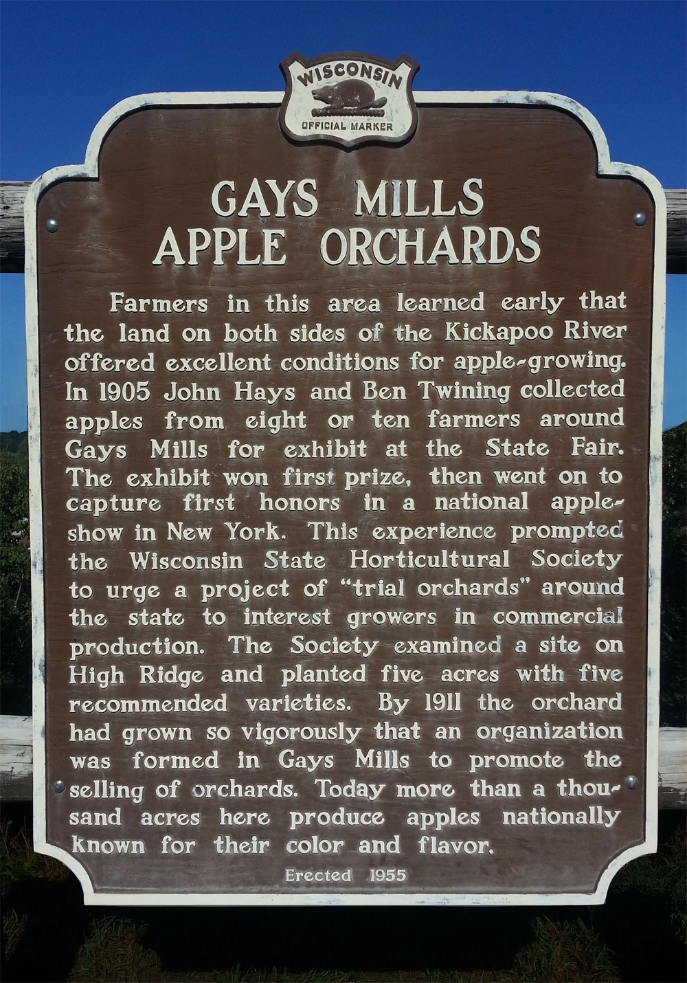
Above: Gays Mills Apple Orchard Marker.
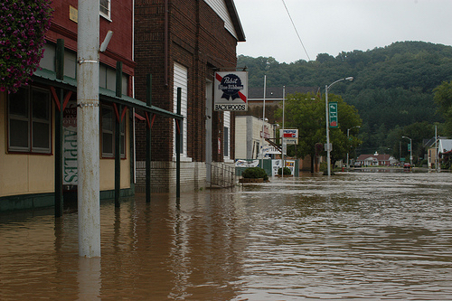
Above: Downtown Gays Mills flooded in both 2007 and 2008.